, Yucatán, Mexico
Suggest Place to Visit
2475
Track to location with GPS |
 |
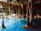
The Yucatan Peninsula is the northern portion of Mesoamerica, which divides the Gulf of Mexico from the Caribbean Sea into the extreme southeast of North America and the northern part of Central America, with a territory of approximately 145,000 km². It is made up of the Mexican states of Yucatán, Quintana Roo and Campeche, although in a strictly physical geography sense, Belize and the Petén in Guatemala also make it up. For the purposes of this article, the peninsular border demarcations are: to the southwest, the mouth of the Champotón River in the state of Campeche; to the northwest the Celestún estuary and the port of Sisal in the state of Yucatán; to the northeast, Cabo Catoche in the state of Quintana Roo; to the southeast, the Bay of Chetumal, in the state of Quintana Roo. In most of this territory, with the exception of the southern part and the coastlines, it is limestone and hard land, lacking rivers and important mountains, in which the water, to return to the sea, breaks a gap in the subsoil once reached the water table, forming cavities and interior waters known as cenotes, which the ancient settlers, the Mayans, used as a vital water reserve.
In the northern portion of the coast, about 7 km east of the port of Progreso, there is a small summer town and fishermen called Chicxulub where it is estimated that a gigantic aerolith called Baptistina fell, 65 million years ago, which formed a gigantic crater of approximately 180 km in diameter and that had among other disastrous consequences, the disappearance of dinosaurs from the face of the earth.
In the northeastern part of the peninsula, the most calcareous, the one that was more rugged, henequen, a plant native to the region, was cultivated since time immemorial, and since the mid-nineteenth century gave rise to an agribusiness, which for many years was the main peninsular economic activity.
The Yucatan Peninsula is the northern portion of Mesoamerica, which divides the Gulf of Mexico from the Caribbean Sea into the extreme southeast of North America and the northern part of Central America, with a territory of approximately 145,000 km². It is made up of the Mexican states of Yucatán, Quintana Roo and Campeche, although in a strictly physical geography sense, Belize and the Petén in Guatemala also make it up.
Mayan archaeological sites: Chichén Itzá (Yucatán); Edzná (Campeche); Calakmul (Campeche); Becán (Campeche); Uxmal (Yucatán); Dzibilchaltún (Yucatán); Mayapán (Yucatán); Kobá (Quintana Roo); Tulum (Quintana Roo); Ek Balam (Yucatan); Izamal (Yucatán) which also has great colonial appeal. Also, the Puuc Route, located to the south of the state of Yucatán, slightly to the north and along the mountain range called Sierrita, on which are the ancient Mayan cities of Loltún, Labná, Kabáh, X-lapac and Uxmal itself, already quoted. All these names only to indicate the most renowned sites, although there are countless others in the process of being discovered and excavated and still many unexplored.
Comments
We don´t have yet any comments about:
Yucatán Peninsula
Yucatán Peninsula
Be the first to leave a comment as it is very important to inform other people
Outros locais a visitar
Within a radius of 20 km from:Yucatán Peninsula
Unfortunately we do not have information on other places to visit in this area yet
Hotel reservation near Yucatán Peninsula within a radius of 20 km
Why to book with TURISMO & VIAGENS
The best prices
Our partnerships with the world´s largest operators offer research on the best market prices.
More options
At Rotas Turisticos you can book the hotel, buy the air ticket, book the transfer from the airport to the hotel and vice versa, book the local excursions, rent the car, take travel insurance and consult the places to visit and where to go.
Holiday Tips & Destinations
Hundreds of holiday destinations with all the options that allow you to easily choose the destination that best suits your dream vacation.
TURISMO & VIAGENS
Links


